World Building – Part 5: Geography
Intro | History | Religion | Working Worlds | Geography | Filling Your World | Your Players | Player Options
There are tons of examples of fantasy worlds that came to life from someone’s imagination when they decided to put their ideas onto a map. My favorite fantasy worlds feel real, even when they are fantastical. Geographic details such as maps and weather can add dimension and space to your setting. Last year, I decided it was finally time to tackle building my own fantasy world and in this article (Part 5), I share how I sketched out a map and starting figuring out the geography of my fantasy world called Vodari. I am a rookie world builder and map maker, but that didn’t stop me from taking my ideas and turning them into my own world that my players and I are visiting each week.
Do I Need a Map?
Yes, you need a map. You don’t need to be an artist, just make sure your map provides a solid, visual way to show people your world. You can always have someone redraw your rough sketch or use a digital tool to create a final version once you get your ideas onto your map. Making maps can even be a fun way to get your ideas out onto a page where you can really start to figure out things like natural borders, who has what resources and who controls access to trade routes.
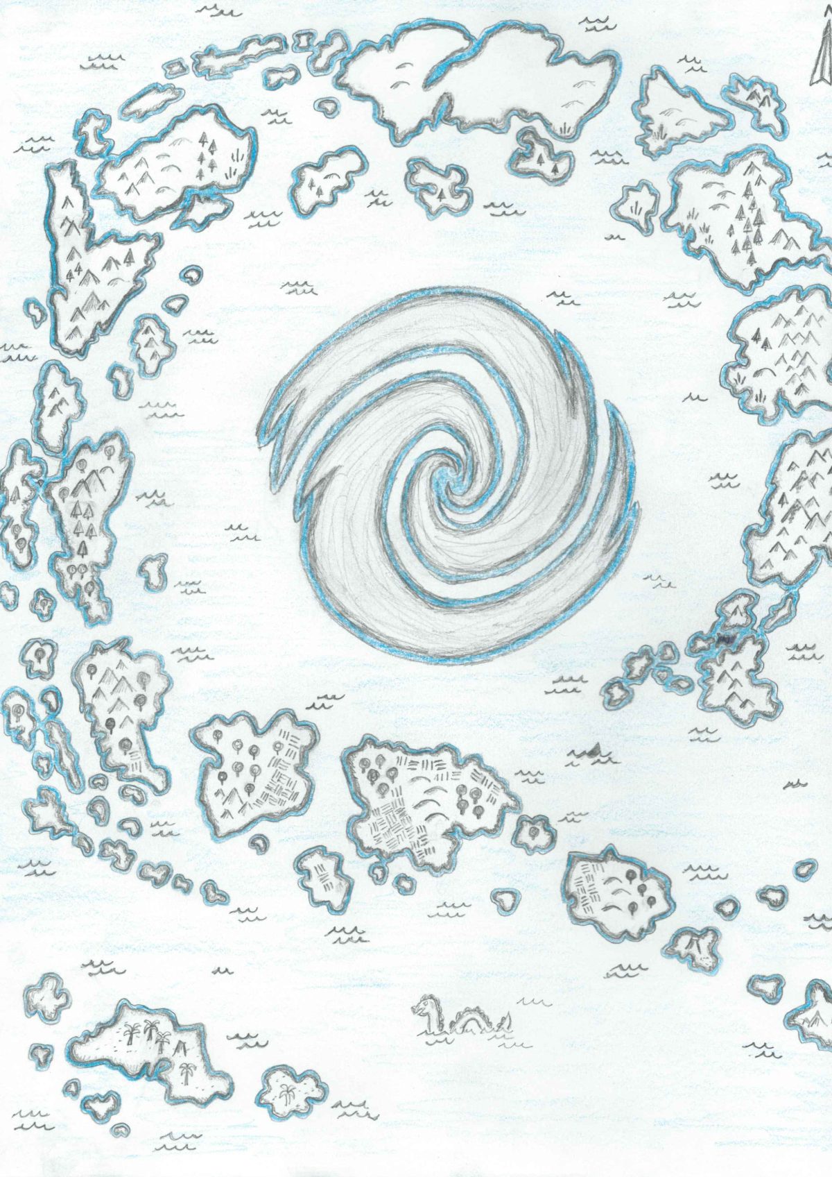
I created a half-decent map for Vodari, but I made some rookie mistakes such as not drawing the map big enough. Overall, it is working well enough in my weekly game and the scale makes traveling quick. My map is on Roll20 with the rest of my game assets, so it acts as a background and I can easily move, show and hide settlements I have placed in a layer on top of the map.
Here is the bottom half of my map of Vodari. You’ll see the hex grid, text and dots all added on top of my map. You’ll also see that I just outlined my rough sketch in pen. I’m hoping to update the map if we play a second campaign in this world.
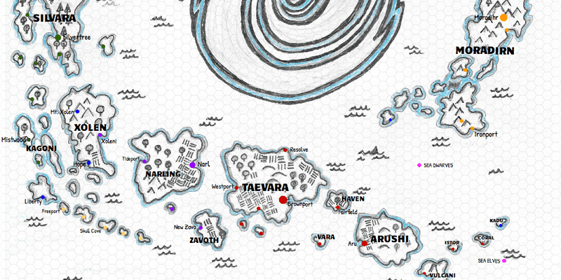
A beautiful map is art, but a simple map is less precious and easy to change. I think a rough map works best during the early world building stage. If you have any ability to draw, I would recommend sketching out your world before you hit up a fancy map builder. As an alternative, you could create a random map and build your world based on what is generated.
Here are some things that I found worked well for me as a rookie world builder looking to make a first sketch map of Vodari.
- Look at existing maps to draw or trace coastal outlines for continents and islands.
- Do make sure that rivers flow downhill from mountains/continental divides into lakes and oceans. Try not to have rivers stop into the middle of a plain or desert, unless you have a good reason that makes sense in your world.
- Once you have an outline of your world, it might be a good idea to copy or scan your map into a digital format before adding in other details. Sharpen up the lines using a filter in your favorite paint program if you know how.
- If your world or area has distinct borders, draw them in and write some notes on how you think the various nations will interact. How will they travel and trade with each other? Look at the map for inspiration on which nations are allies and which and enemies. My map has a lot more water than land, so I decided that war would have been waged on the sea or along the coast.
- How large is this world? What is the scale of your map? How long would it take to travel between settlements?
- Figure out the climate of your world. Are there polar or tropical areas? Where should glaciers, deserts and forest go? Make sure to think about how climate impacts the people of your world. In my world, Ice Dwarves have adapted to the cold after countless centuries of mining diamonds and gold in the far north.
- Draw in other geographical features such as mountains, rivers, lakes and forest. Simple icons or shapes can work great. Upside down Vs for mountains, circles with a stem for trees and houses for towns. If you scan your sketch into digital you can use icons or dots for this stage. For my map, I just used different color dots to represent which kingdom a settlement was part of and labelled them with a name.
- Are there any other special features on your map? My map has a giant magical hurricane in the center above what used to be a small continent. I decided that there would be few settlements on the storm side of islands, since those places would be blasted off the map by the worst storms.
What About Calendars and Seasons?

I didn’t really see any reason to get to creative with this aspect for my world, so I went with twelve months and four seasons. A calendar is just another way to make your world feel like a real place. Having a date like 8 Taeva 988 AG is more immersive for you and your players than “I guess its summer, like July or something.”
The scale of my world is totally unrealistic based on the distances of my map. This might be something I fix in the future, but for now my players can scoot around the map in short journeys that last days, not weeks. The next time I build a world, I’ll have a better idea on how to draw a map and avoid this mistake and some other mistakes I made and have mostly fixed.
Most of the people of my world live in a temperate climate where it snows rarely, or not at all. I modeled the seasonal variation for the heavily populated southern part of my map to have a climate similar to Bermuda or the Caribbean. As you travel further north it becomes more typical of what your would find in the Pacific Northwest of the United States and Canada. As you travel to the far north, the climate become Scandinavian, a great place for the viking inspired barbarians and their enemies the orcs to live.
When creating your calendar, you can use an existing fantasy calendar or get creative and come up with something that is 100% original. For my calendar I looked at existing calendars in other D&D worlds and added in my gods to the widely used Common calendar. I also focused on the Elf/Gnome and Dwarven calenders since those would applicable to some of my players too.
| Month | Common | Elven/Gnome | Dwarven |
| January | Coldwind | Winter Cold | Dark-Crypt |
| February | Sashelas | Winter Deep | Dark-Deep |
| March | Eadro | Spring Dawn | Damp-Mood |
| April | Elhonna | Spring Rain | Damp-Chisel |
| May | Tero | Spring Blossom | Damp-Anvil |
| June | Greenfield | Summer Home | Dry-Axe |
| July | Taeva | Summer Run | Dry-Heat |
| August | Holladra | Summer End | Dry-Forge |
| September | Harvest | Autumn Harvest | Cold-Hammer |
| October | Toamna | Autumn Twilight | Cold-Steel |
| November | Leafdown | Autumn Dark | Cold-Rust |
| December | Longnight | Winter Night | Dark-Night |
The Minotaurs (homebrew playable race I added to world) and evil humanoids have their own calendars too, but I have not detailed those calendars yet.
In Part 3: Religion I covered some festivals and important dates related to the calendar above.
Each week I’ll add another part to this series. Here is a list of the published and upcoming parts.
- Part 1: The Big Picture
- Part 2: A History for Your World
- Part 3: Religion
- Part 4: Making Your World Work
- Part 5: Geography
- Part 6: Filling Your World
- Part 7: Letting Your Players into the World
- Part 8: Providing New Player Options
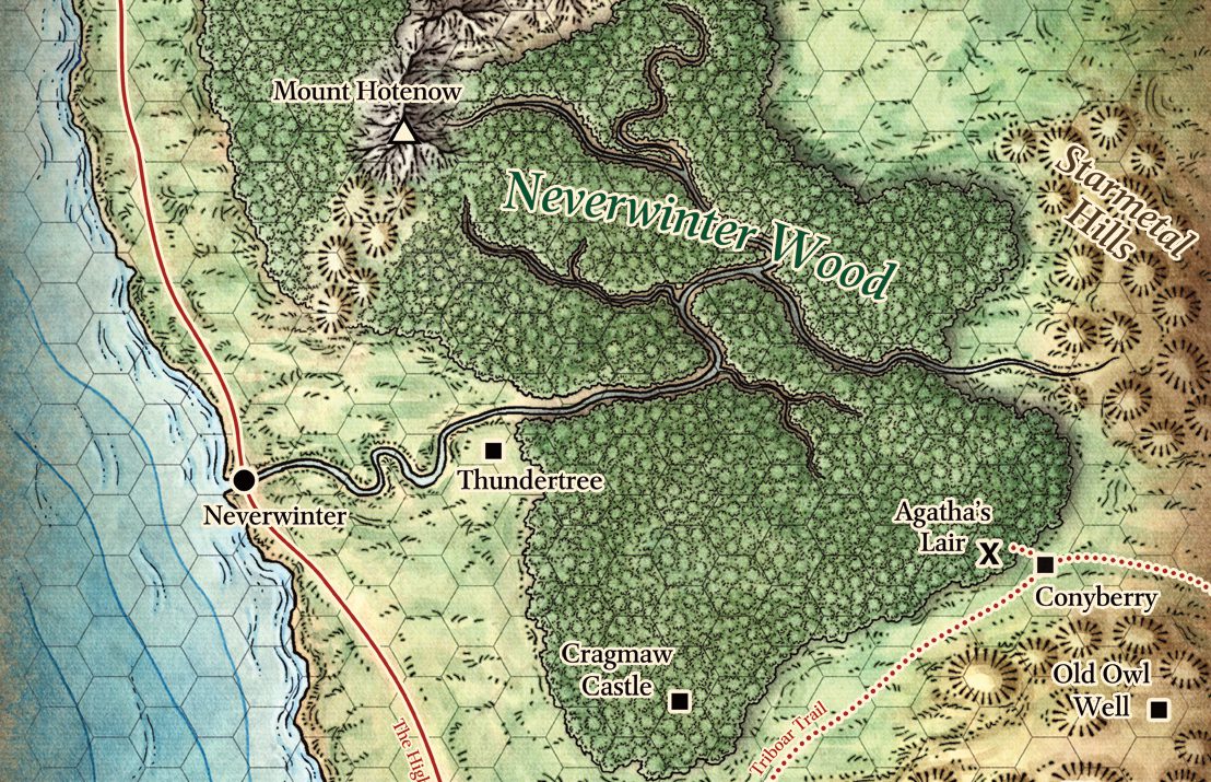
The first map is a portion of the Sword Coast (Forgotten Realms) from the D&D 5th Edition Starter Set.